Without Wyndstep
- Bids built on rough estimates and site walks
- Hard to document existing site conditions
- No visual record if conditions change scope
- Owners can’t easily visualize your plan
Premium drone + ground capture and a full Virtual Design & Construction workspace — the tech the big GCs use, priced per service with no contracts. Built for small general contractors.
The drone mapping and Virtual Design & Construction platforms that national builders rely on come wrapped in enterprise contracts, annual minimums, and per-seat licensing. The kind of money that only pencils out when you're running dozens of sites at once.
So the small general contractor gets left with a tape measure, a phone full of blurry jobsite photos, and a clipboard. You're expected to compete with the big builders while flying blind on the very data they take for granted.
That gap isn't a technology problem. It's a pricing problem.
Wyndstep isn't a venture-backed platform chasing thousands of enterprise seats. It's a lean, low-overhead operation focused on one kind of customer: the small general contractor who wants the same site intelligence the big builders use, without the big-builder invoice.
Because the overhead is low and the focus is narrow, the pricing can be honest. You pay per service for exactly what you need — no contracts, no seat licenses, no minimums. The mission is simple: put professional-grade site data in the hands of the contractors who've been priced out of it.
Justin Tyner
Founder & Operator, Wyndstep
Every capture flows into a single Virtual Design & Construction workspace your whole team can use.
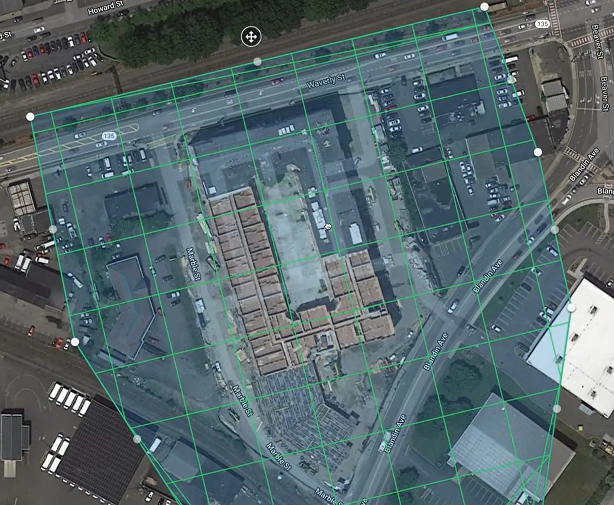
Precise, measurable top-down imagery of your whole site, stitched from hundreds of photos.

Walkable site geometry for inspections, visualization, and measurement.
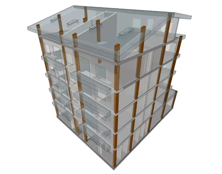
Check as-built progress against your IFC, DXF, or PDF plans.
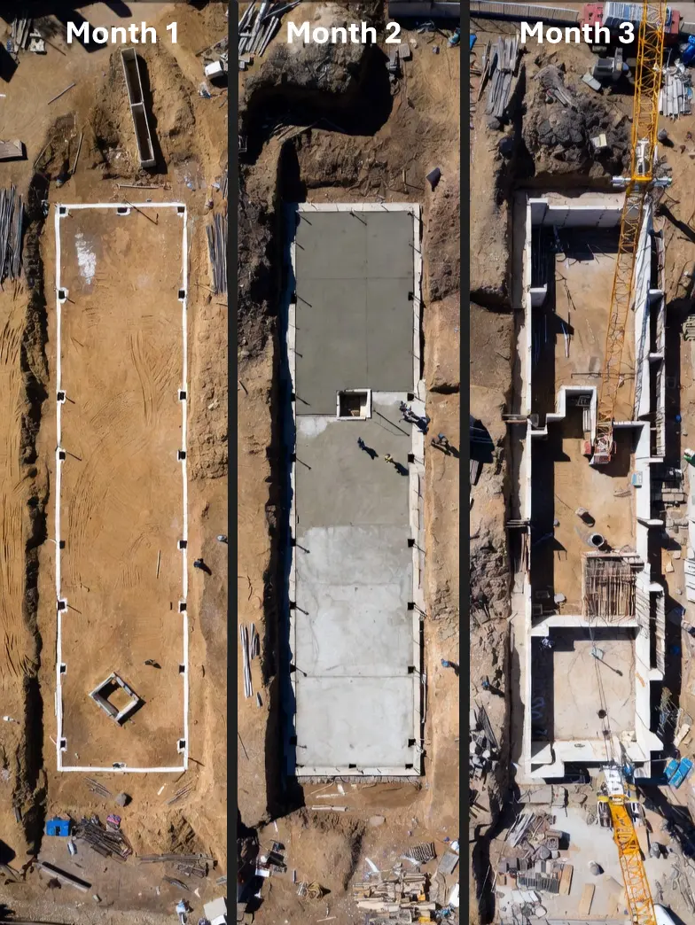
Layer captures over time to track progress and catch issues early.
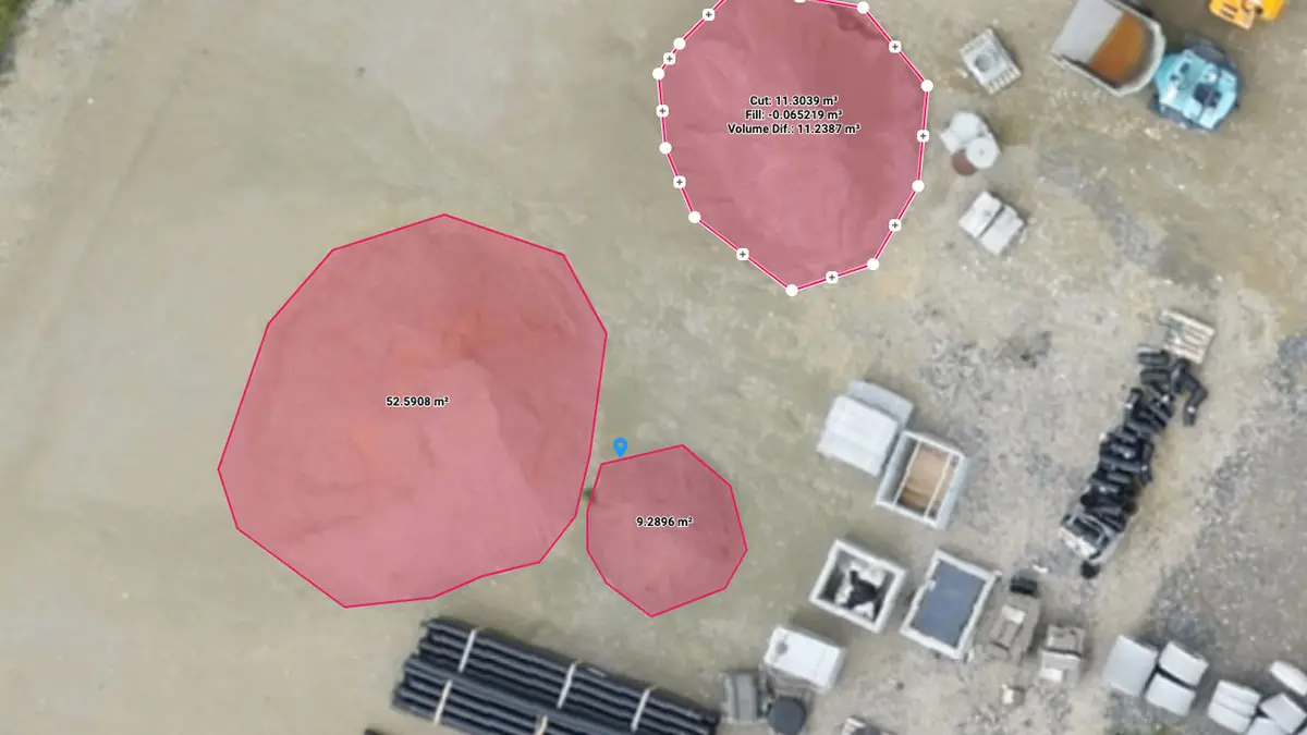
Distance, area, volume, and elevation insights in an intuitive cloud workspace.
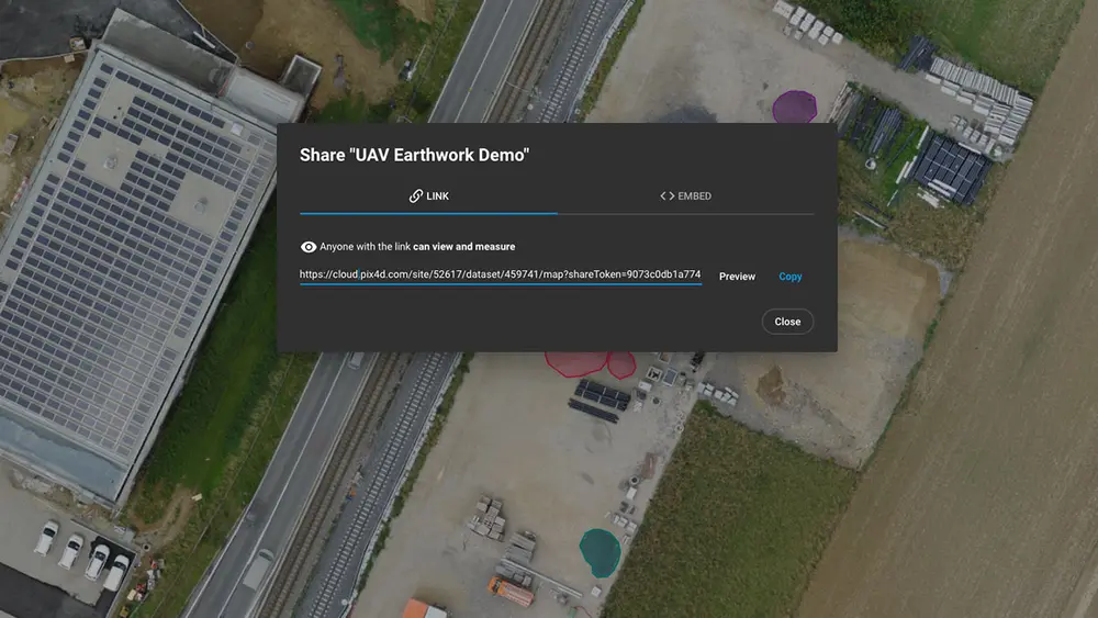
Send secure web links to your team, subs, or clients — no software to install.
A cinematic marketing clip of your project, optimized for social — on the house.
Drone-only providers map your rooftops and earthwork but miss what's happening inside and under the structure. Ground-only documentation captures the details but never the full-site context.
Wyndstep captures both — aerial orthomosaics and 3D models from above, plus ground-level capture where it matters — and fuses them into one workspace. You get the complete picture of your jobsite, not half of it.
Subcontractor delay & dispute
Delays and quantity fights with earthwork, grading, and material trades eat schedule and margin. Phone photos and walk-downs aren't enough when an invoice and a site condition don't match. Wyndstep gives you measurable, dated evidence from the air.
Owner payment & draw disputes
When an owner holds a draw or questions retainage, blurry jobsite pics and your word against theirs won't move the invoice. Time-stamped aerial progress documentation makes what's done — and what isn't — impossible to argue away.
Change order & scope disputes
Change-order fights start when nobody agrees what the site looked like before the extra work. A georeferenced baseline and as-built record turns “that was always there” into a dated, measurable comparison.
Book a free demo call — we'll fly your actual job site so you can see the data before you decide — or get an instant quote for your site.
No commitment. North Texas GCs only. We won't waste your time.
Win more work
When owners evaluate bids, they're not just looking at your number — they're evaluating your professionalism and your risk. A GC who shows up with accurate site maps, documented existing conditions, and a clear baseline looks like less of a liability. That matters when you're competing against firms twice your size.
Stay on schedule
By the time a scheduling problem is visible from the ground, you're already behind. Scheduled recurring capture gives you a bird's-eye view of progress across your whole site — grading completions, phase boundaries, stockpile volumes — so you can spot drift before it compounds. Capture more frequently during high-risk phases; scale back when the work settles.
48hr
Typical turnaround from flight to delivered data
1 flight
Replaces hours of manual measurement and site walking
Date-stamped
Records organized by project and capture date — a visual history you can defend
See exactly what’s complete, what’s underway, and what’s stalled — across your whole site, not just where your super walked today.
Know your material quantities without manual counts. Avoid over-ordering, under-ordering, and the arguments that come with both.
Schedule recurring captures of the same site and build a date-stamped visual record of progression — invaluable for owner reporting and change order defense.
Schedule a free demo flight on your site, or price your project in seconds. No commitment either way.
No commitment. North Texas GCs only. We won't waste your time.
Remote site visibility
Scheduled jobsite capture at the frequency your project needs — daily, weekly, monthly, or at critical milestones. Principals and PMs get remote visibility into every active site without another truck on the road, and without equipment purchases or long-term platform commitments.
Daily, weekly, monthly, or at critical milestones — capture more frequently during high-risk phases, and scale frequency up or down as the project changes.
Every capture lands in one portal, organized so you can compare progress over time. Share individual site links with owners, PMs, or investors without giving away access to everything.
We handle scheduling, capture, and delivery. You review the data before your next site visit — and show up already knowing what to ask.
You can hire a drone. You can't hire the thing that actually protects you when a job goes sideways.
Orthophotos, point clouds, 3D surface models, and volume calcs — not raw video. A raw clip doesn’t win a dispute. Measurable data does.
We know DFW construction. Fast turnaround, easy scheduling, and we show up knowing what a Texas job site looks like — not learning on your dime.
All your site data in one place. Send a link to your owner, your PM, or your sub. Nobody argues with a time-stamped 3D model.
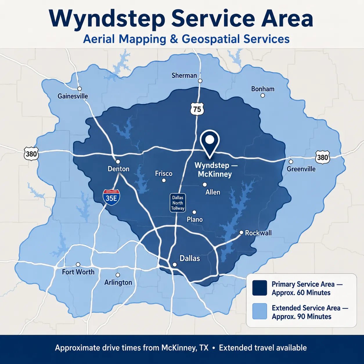
Based in McKinney, we primarily serve sites within about an hour — with extended coverage out to roughly 90 minutes. Farther out? Ask us — travel is often available.
Straightforward pricing built for how small contractors actually work.
Flights starting at $499 in the McKinney area.
Select and pay for each capture session — one milestone or a recurring series. Scale frequency up or down as the project changes.
No equipment purchase, no long-term platform commitment, no annual minimums or per-seat licensing. Use Wyndstep when a job calls for it.
The full Virtual Design & Construction workspace — measurements, overlays, comparisons, and sharing — comes with your capture. Not an upsell.
A 20-minute call, no pitch, no obligation. Tell us what you're working on and we'll be direct about whether Wyndstep makes sense for your projects.
No commitment. North Texas GCs only. We won't waste your time.
Book a single session or recurring captures at the frequency your project needs — daily, weekly, monthly, or at critical milestones.
On-time arrival, safety-first operations, and efficient air + ground coverage of your jobsite.
Your orthomosaic, 3D model, and overlays are processed and loaded into your VDC workspace.
Measure, compare captures over time, and share secure links with your team and clients.

Who's behind the work
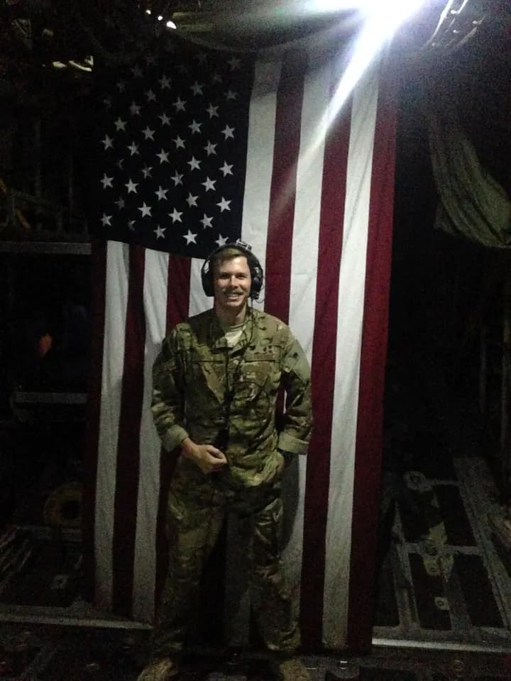
Justin is an engineer, USAF aviator, commercial pilot, and certified remote pilot with a career spanning both manned and unmanned aviation. He's managed complex contracts and delivered geospatial products to clients from government agencies to private developers.
Every Wyndstep project is run with the same discipline: clear communication, accurate data, and uncompromising professionalism — at a price small contractors can stand behind.
Your first capture is free on qualifying projects. Walk your jobsite inside the VDC workspace, see the data quality for yourself, and decide whether it earns a place in your workflow.
No contract. No commitment. Only pay if it adds value.
Book a quick call, or price your project in seconds. No commitment either way.
Prefer to call? (972) 372-4726